
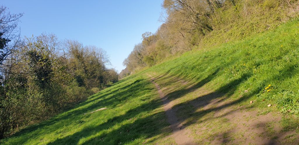
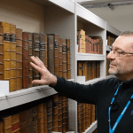
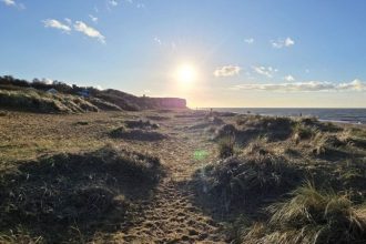
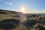
North West Norfolk. UK: A 1+ hour cycle ride from Huns’ton to Ringstead & back via the Down’s. An area with a ‘travel-through’ Esker formation. In other words, riding a ‘Fluvioglacial Landform’. Gnarly dude 😉 ♥️ (See text ‘below’ for Geological details).

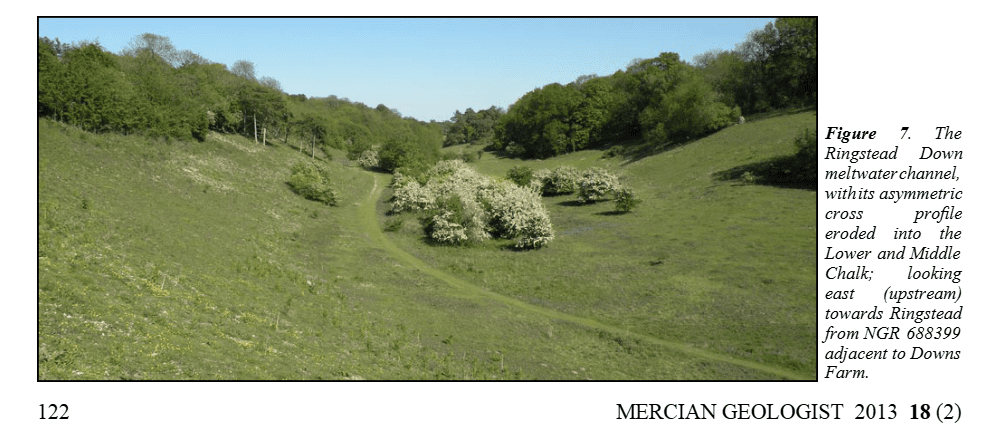
- Period: The valley was formed during the late Devensian, the last glacial period, when ice advanced into northwest Norfolk.
- Formation Mechanism: As the North Sea ice sheet retreated, massive volumes of meltwater (fluvioglacial action) cut through the chalk bedrock.
- Geological Context: It is associated with the deposition of the Hunstanton Till and the Ringstead Sand and Gravel Member.
- Legacy: The steep-sided, non-arable valley is now a Norfolk Wildlife Trust nature reserve (Site of Special Scientific Interest) known for its species-rich chalk grassland.
Fluvioglacial landforms or glaciofluvial landforms[a] are those that result from the associated erosion and deposition of sediments caused by glacial meltwater. Glaciers contain suspended sediment loads, much of which is initially picked up from the underlying landmass. Landforms are shaped by glacial erosion through processes such as glacial quarrying, abrasion, and meltwater. Glacial meltwater contributes to the erosion of bedrock through both mechanical and chemical processes.[3] Fluvio-glacial processes can occur on the surface and within the glacier. The deposits that happen within the glacier are revealed after the entire glacier melts or partially retreats. Fluvio-glacial landforms and erosional surfaces include: outwash plains, kames, kame terraces, kettle holes, eskers, varves, and proglacial lakes.[4]
Meltwater streams are formed by glaciers, especially in warmer seasons. Supra-glacial streams, are those above the glacial surface, and subglacial streams, those beneath the glacial surface.[5] At the interface of the glacier and the underlying land surface, the immense weight of the glacier causes ice to melt and produces subglacial meltwater streams. These streams under immense pressure and at high velocities along with the overlying weight of the glacier itself are able to carve into landscapes and pluck sediment from the ground.[6] This sediment is transported as the glacier advances. In warmer seasons, the glacier diminishes and retreats. This process leaves behind dropped sediment in the form of depositional landforms.[7] The two processes of advancement and retreat have the power to transform a landscape and leave behind a series of landforms that give great insight into past glacial presence and behavior. Landforms that result from these processes include moraines, kames, kettles, eskers, drumlins, plains, and proglacial lakes.


One Comment
The freshest air, anywhere!